

Long Lane Royal
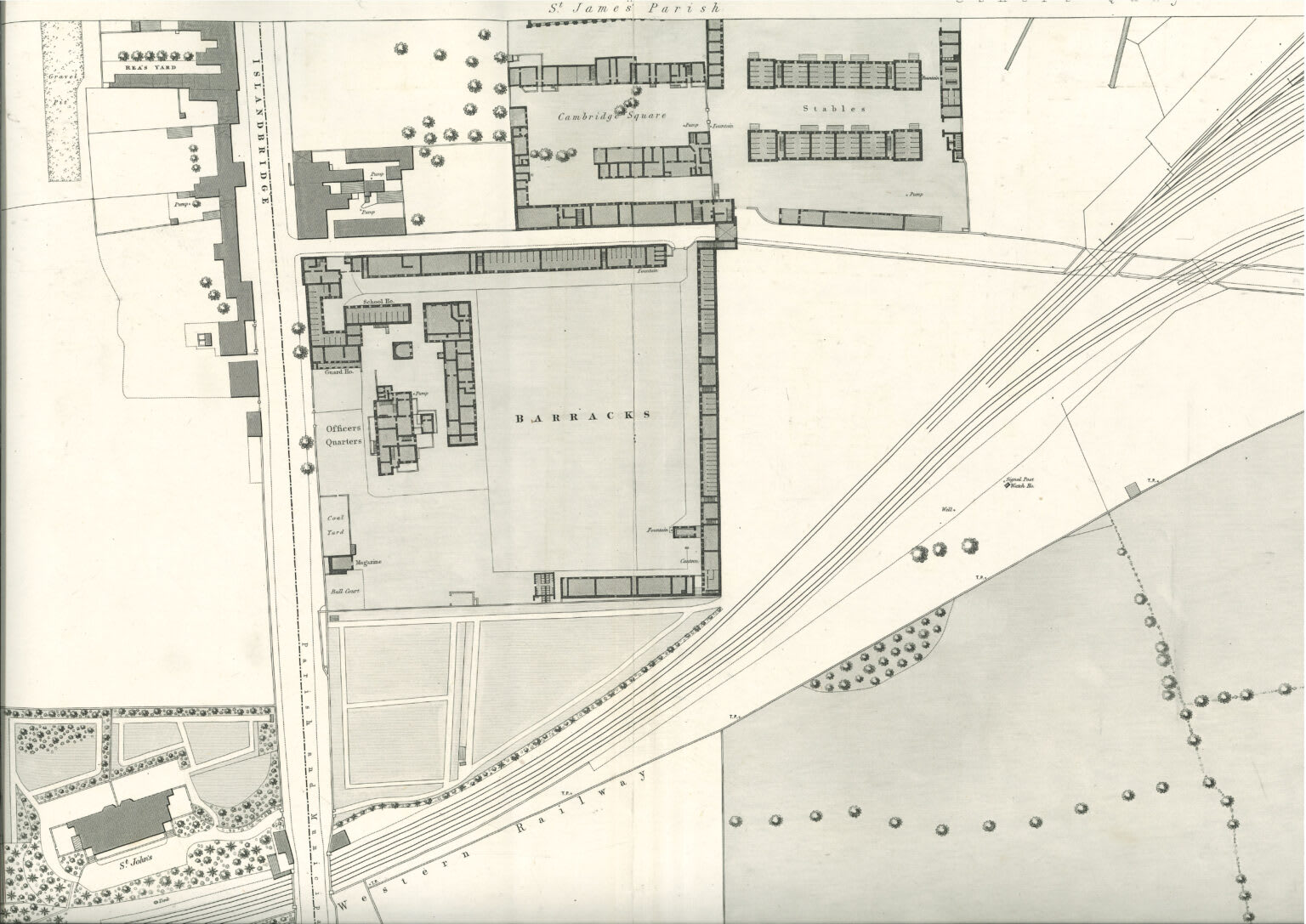
13Long Lane Royal connected the Royal Hospital Kilmainham with Islandbridge. It dates back to the early 1700s. When the barracks was built by the Ordnance Board in 1797, this public road divided it in two: to the south was the barracks buildings and to the north various Ordnance Board and private buildings, and eventually Cambridge Square. As it was a public road, for security reasons any part of the barracks along it (for example, the rear of Colonnade), had to be both strong and to have small windows, only on the upper floor.
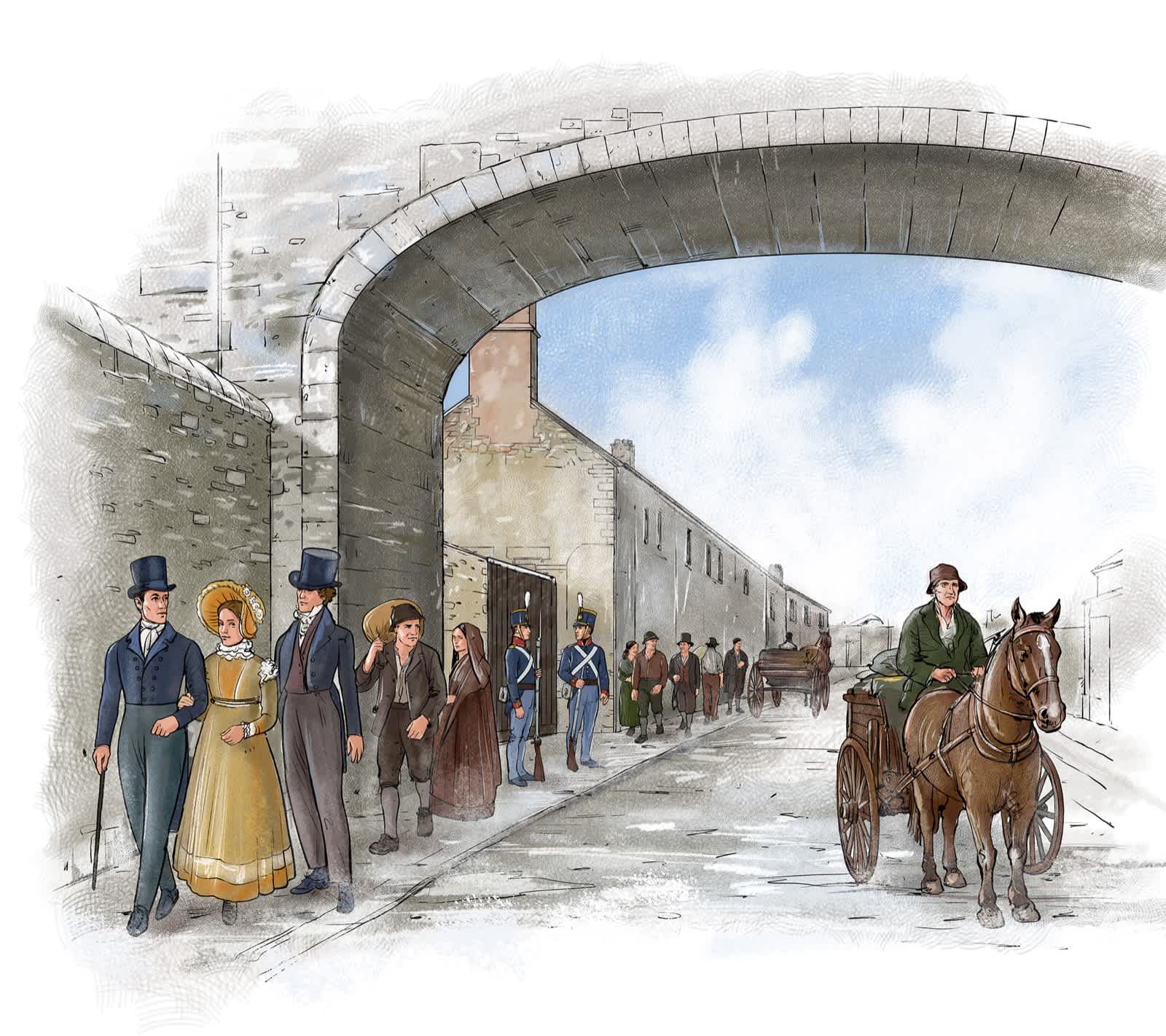
Maps from the 1820s to the 1840s, show a bridge over Long Lane Royal, at the eastern end of the Colonnade building, marking the entrance to the barracks from the direction of Kilmainham. When the railway lines were built in the 1840s, the road was closed, becoming an internal road within the barracks.
Brewery
This building is named after one of the earliest buildings mentioned on the site. Around 1695, part of the estate belonging to Sir William Robinson was leased by him for a brewery, known as Davies’ brewery. The brewery was located to the north of the site, near the river.
A dividing line
Since Long Lane Royal existed as a road before the barracks was built, the barracks had to develop around it. The main barracks with stabling and accommodation lay to the south of the road, around what became known as Upper Square, or the Parade Ground. To the north of the road development was more piecemeal. In the area to the east of the Cobbles building there were horse artillery stables, some accommodation, engineers’ workshops and stores. The barracks hospital stood just to the west of Cobbles. However, the remainder of the land between Cobbles and the South Circular Road was in private ownership and remained as such until later in the 1800s. There was an entrance to the northern part of the barracks from Long Lane Royal just adjacent to where this stop (no. 13) is.
Bridging the divide
From early on the two sides were linked by a pedestrian bridge spanning Long Lane Royal. No traces remain of the bridge today but it was located close to this stop (no. 13). Although the bridge appears on plans of the barracks from the early 1800s, there are no images of it and so it is impossible to know exactly what it looked like.
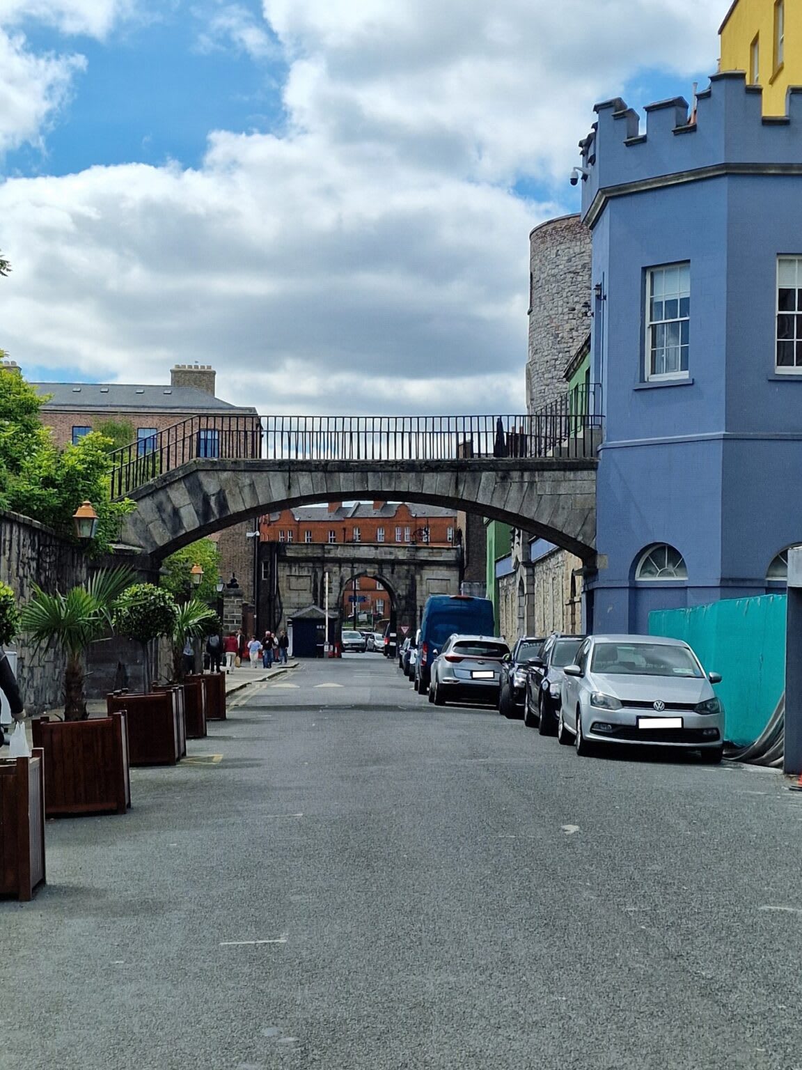
A pedestrian bridge links Dublin Castle’s Octagon Tower with the Castle gardens and is of a similar date, dating to 1790 to 1810. However, that bridge lies within the Castle’s estate and it is an open bridge with a metal hand rail. In contrast, the bridge at Islandbridge Barracks was linking two military establishments either side of a public road. It is likely, particularly after the attempted rising led by Robert Emmet in 1803, that it would have had a more enclosed walkway – either completely roofed over or at least protected by higher walls, rather than a metal railing.
The coming of the railways
In 1844 work began on the line that would become the main Dublin to Cork railway. The following year, the Great Southern Railway Company, wanting the land, offered to rebuild the barracks elsewhere, but the offer was refused. The eventual route ran in a diagonal line just to the south of the barracks, but cutting across Long Lane Royal. The Dublin terminus was Kingsbridge, today called Heuston station, which opened on 4 August 1846. Once the line was completed the road was used less, although the decision to officially close it was only taken in 1873.
(With the permission of the Board of Trinity College Dublin)

Index >
- Stop 1 > The Officers’ Mess
- Stop 2 > The Schoolhouse
- Stop 3 > Colonnade
- Stop 4 > Peadar Clancy
- Stop 5 > Foley House & Laverty House
- Stop 6 > Tarrant House & Cambridge Sq.
- Stop 7 > Dickie Bird
- Stop 8 > Heuston
- Stop 9 > Cobbles
- Stop 10 > The River Liffey
- Stop 11 > Watch Tower
- Stop 12 > Stables, Saddlery, Armoury & Summerhouse
- Stop 13 > Long Lane Royal